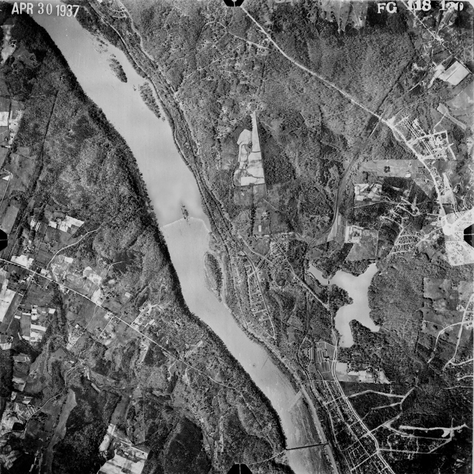
The aerial photograph below (0.46MB) was donated to the club by Mark Strasburg and dates to April 1937. Clicking on the image will deliver the same picture in considerably greater detail (2.38MB) but may take about 4 times as long to download to your browser, depending on your connection. The detail is spectacular though.
The top of the picture is North. For those who are interested in the area's development, it is quite clear that almost the whole of western Bethesda was built after World War II. On the Virginia side, there is no CIA or George Washington Parkway as there is today, only farmland and forest.
Chain Bridge is clearly visible at the bottom of the picture and Dalecarlia Reservoir is the body of water east and north of it. The dam in the river is the old canal feeder dam; the Little Falls Brookmont Dam wasn't constructed yet. MacArthur Boulevard (then Conduit Road) and Massachusettes Avenue are clearly visible, as is Walhonding, leading directly east from Sycamore Island and up to Massachusettes Avenue. Compare this picture to the 1932 hand-drawn map of roughly the same area.

